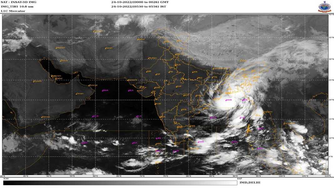
Guwahati, Oct 24: Six of the eight northeastern states on Sunday have sounded a maximum alert and asked all the concerned districts, disaster management authorities and agencies to remain maximum alert with all precautionary measures to deal with the heavy to very heavy rainfall predicted in view of the cyclone ‘Sitrang’ on Monday to Wednesday.
Maximum rainfall has been predicted up to 200 mm.
The state governments have asked the National Disaster Response Force (NDRF) authority to deploy additional troops in the probable areas, where heavy to very heavy rainfall would occur in view of the cyclone ‘Sitrang’ on Monday to Wednesday.
The India Meteorological Department (IMD) on Sunday said that light to moderate rainfall at most places with heavy to very heavy rainfall at isolated places over south Assam, East Meghalaya, Nagaland, Mizoram, Manipur and Tripura expected to occur from Monday to Wednesday.
“Extremely heavy rainfall over Tripura and Mizoram is likely to occur till October 26 (Wednesday),” the IMD said in a statement.
Three southern Assam districts — Cachar, Karimganj and Hailakandi, all 11 districts of Mizoram, all 8 eight districts of Tripura and most of the 16 districts of Nagaland have taken a series of measures to deal with the possible cyclonic situations.
The IMD statement said that the deep depression over east central Bay of Bengal moved northwestwards with a speed of 20 kmph during past six hours, and lay centered on Sunday morning over west central and adjoining east central Bay of Bengal and about 640 km northwest of Port Blair, 670 km south of Sagar Island and 820 km south-southwest of Barisal (Bangladesh).
It is very likely to move northwestwards during next 12 hrs and intensify into a cyclonic storm over central Bay of Bengal.
Thereafter, it would recurve and move north-northeast wards and cross Bangladesh coast between Tinkona Island and Sandwip, close to Barisal October 25 early morning.
The IMD tweeted at 9.47 p.m. on Sunday night : “DD over WC BoB intensified into the CS SITRANG at 1730 hrs IST of 23rd Oct near lat 16.40N and long 88.10E, 580 km south of Sagar Island and 740 km south-southwest of Barisal (Bangladesh). To move north-northeastwards and cross Bangladesh coast between Tinkona Island and Sandwip.”
In Agartala, Tripura Chief Minister Manik Saha reviewed the situation with all line departments, Army and Central para-military forces seeking their active support.
Tripura Information and Cultural Affairs Minister Sushanta Chowdhury while briefing the media said that the state government cancelled the leaves of all officials for the next one week and schools and educational institutions would be closed for three days from October 24.
The Tripura government has taken 30 point steps and actions. These include, regulations of movement of vehicles across the state on October 25 and 26, opening of adequate number of relief with adequate quantities of relief materials, miking of the situation for preparedness of the people, readying of adequate number of Quick Reaction Teams and regular assessment of the situations.


