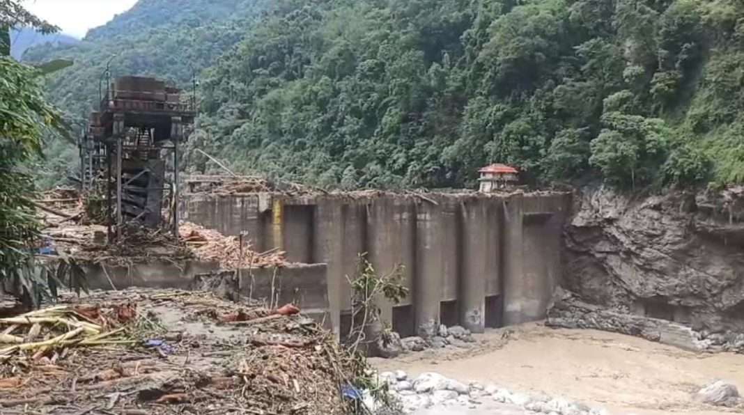
Guwahati, Mar 5: There is a growing concern over the safety of construction of mega dams in India and particularly in Arunachal Pradesh in wake of recent incident of the Glacial Lake Outburst Flood (GLOF) scenario in Teesta Valley (Sikkim) in Oct 2023.
The NHPC in a statement said that the technical facts corroborating the Glacial Lake Outburst Flood (GLOF) scenario in Teesta Valley are entirely different than the prevailing glacial lakes and their likely impact on proposed Dams in Arunachal Pradesh.
There are several glacial lakes in Teesta Basin, upstream of Teesta III dam (Chungtham Dam), which have been studied periodically due to their potential impact on dams resulting from Glacial Lake Outburst Floods (GLOFs).

In 2015, the Central Water Commission (CWC) conducted a study titled “Status of Glacial Lakes & Water Bodies in the Himalayan Region of Indian River Basins,” in collaboration with the National Remote Sensing Centre (NRSC), ISRO.
A GLOF event originating from South Lhonak lake (located approximately 70 km upstream of Teesta III Dam) could have been triggered by various factors, such as an earthquake, flash flood, Glacier Calving, or breaches due to the detachment of moraine sidewalls or a combination of these events.
Most of the glacial lakes present in Subansiri, Siang and Dibang river catchments are present in Chinese portion of these river catchments, which are far away from NHPC projects hence posing insignificant threat of GLOF induced flood.
The topographic, catchment characteristic, glacial lake locations in river basins in Arunachal Pradesh are different in following aspect which indicated there are no chance of GLOF induced flood disaster for projects in Subansiri, Siang and Dibang Basins as it was in Teesta Basin GLOF case.
The glacial lakes are located far away from NHPC dams as a result of this Glacial Lake Outburst Flood (GLOF) get attenuated to a very low flood values.
The slope of rivers are mild hence flow velocities of flood water is lower, also leads to higher travel time and more time to take action to mitigate the effect of flood.

Due to presence of huge reservoir storage volume the Glacial Lake Outburst Flood (GLOF) volume will be completely absorbed into reservoirs hence no threat to dam or to the downstream population.
As per existing studies the peaks of GLOF at dam sites are even much lower than average monsoon flood for Subansiri, Siang and Dibang basin projects of NHPC.
Most of the glacial lakes are present in Subansiri river catchment are present in Chinese portion of the Subansiri river catchment which are far away from Subansiri Upper Project (SUP) and Subansiri Lower Project (SLP) hence posing insignificant threat of GLOF induced flood.
The slope of river Subansiri from some large glacier lakes up to SUP dam site is of the order of about 1 in 70. Also potentially dangerous lakes are located at more than 150 km upstream of SUP dam. The reservoir capacities at Full reservoir Level (FRL) & Maximum Water Level (MWL) are 1755 MCM & 1988 MCM respectively along with live storage of about 745 MCM which is very large to absorb the GLOF volume.
The slope of river Subansiri from vulnerable glacier lakes up to SLP dam site is of the order of about 1 in 100. Also potentially dangerous lakes are located at about 260 km upstream of SLP dam. The reservoir capacities at Full reservoir Level (FRL) & Maximum Water Level (MWL) are 1365 MCM & 1474 MCM respectively along with live storage of 645 MCM which is very large to absorb the GLOF volume.

Kamla HE Project (KHEP), also known as Subansiri Middle Project, is located on river Kamla, a right bank tributary of river Subansiri. The slope of river Subansiri from some large glacier lakes up to KHEP dam site is of the order of about 1 in 50. Also potentially dangerous lakes are located at about 140 upstream of KHEP dam.
The reservoir capacities at Full reservoir Level (FRL) & Maximum Water Level (MWL) are 1928 MCM & 2366 MCM respectively along with live storage of about 624 MCM, which is very large to absorb the GLOF volume.
Also Watch:
Find latest news from every corner of Northeast India at hubnetwork.in, your online source for breaking news, video coverage.
Also, Follow us on-
Twitter-twitter.com/nemediahub
Youtube channel- www.youtube.com/@NortheastMediaHub2020
Instagram- www.instagram.com/nemediahub


