
Jowai, Dec 6: The Executive Committee of the Jaiñtia Hills Autonomous District Council (JHADC) under the leadership of its CEM Thombor Shiwat on Tuesday visited the Mukroh village, falling under Elaka Shiliang Myntang, West Jaiñtia Hills.

The EC of the Council on reaching Mukroh met the elders of the village and headed to the border of the village along the Barato – Mukoilum Road and the Zero Point, known as Mutha Siang Kwai, which is about 3-4 km from Mukoilum Police Outpost of Assam. As per the map produced by the elders of the village, which was formally issued in 1968, it clearly demarcates the boundary of the Village.
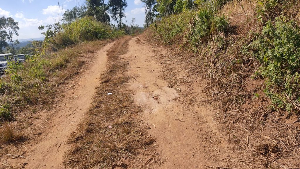
As per the elders of the Village and the Map that was produced, it clearly states that the point (Barato-Mukoilum) and Kutcha road is the Zero Point of the Meghalaya and Assam Border and very much within Mukroh village and the point exceeding it is Elaka Labang Nongphyllut.

At the spot where the unfortunate incident occurred during the early hours of 22nd November, 2022, the Executive Members of the Council also observed a minute of silence for the five innocent souls who were shot dead by the Assam Police and the Forest Guards of Assam.
The EC of the JHADC also met the elders of the village to hear their concerns pertaining to the continuous atrocities committed by the Assam Government against them.
